Dabes Diversion Loop
A classic hike on the FLT system, this hike features cascading streams, a steep climb, and a view at the top as a reward. This can be easily combined with the Virgil Mountain Loop or the Lithuanian & Irish Loops for an extended route.
Map of the Dabes Diversion Loop
You can navigate this route with the AllTrails map, linked here.
The trailhead for this hike is located at the corner of Hauck Hill Road and Bleck Road, where there is shoulder parking. The GPS coordinates are 42.48862, -76.17707.
From the trailhead (1835’), follow the dirt Hauck Hill Road east, which is marked with orange blazes of the Dabes Diversion Trail. The trail follows the dirt road for the first 0.8 miles. 0.4 miles from the start, the blue-blazed Kuzia Cut-off Trail leaves the road to the right. This trail connects to the main FLT and can be used to shorten the regular Dabes Diversion Loop. Continuing straight, the trail descends moderately until an intersection with Cortwright Road at 0.8 miles. Turn left here and follow the road briefly, but then turn right again on a snowmobile route (still marked with orange blazes). After a short climb, the trail reaches a four-way junction with the main Finger Lakes/North Country Trail and the orange-blazed Virgil Mountain Trail at 1.0 miles (1660’). From here, turn right to follow the white-blazed FLT/NCT into a coniferous forest.

Four-way intersection
The FLT/NCT continues through a primarily coniferous forest, descending slightly. Eventually, the trail approaches a brook where there are two crossings, both of which can be difficult when the water level is high. After both of the crossings, the trail ascends steeply to cross Cortwright Road again at 1.9 miles (1590’). Immediately after the crossing, the blue-blazed Kuzia Cut-off is on the right of the trail. After passing next to a clear-cut section of forest on the right, the trail crosses Bleck Road.

FLT/NCT through a coniferous forest
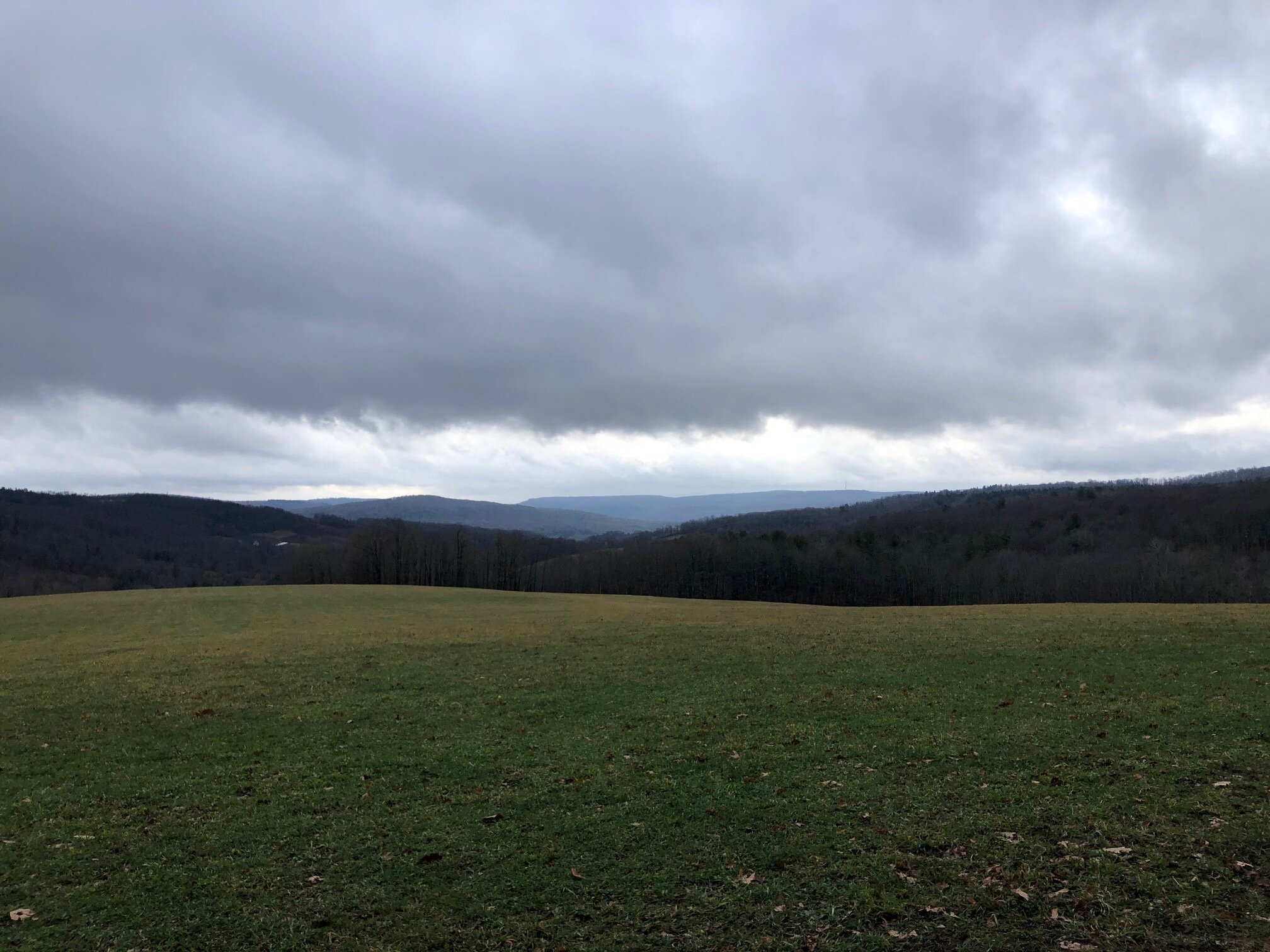
Continuing across the road, the trail descends to the last water crossing of the route. This one is usually the most difficult as there aren’t many rocks to assist trail users in crossing. If the water level is too high, there are some better crossing spots a short distance upstream. After this crossing, the trail ascends steeply, eventually paralleling a field until it reaches a large rock pile at 2.5 miles. On the left, there is a nice view to the south. This is also the turnoff for the orange-blazed Dabes Diversion Trail which leads back to the trailhead. Turn right here and follow the orange blazes.

View from the rockpile
The orange-blazed trail ascends gradually for 0.6 miles until the highest point on the loop is reached (1890’). From here, the trail descends on the backside of the hill until it reaches the trailhead parking in one mile. Total distance for this hike: 4.2 miles with 610 feet of elevation gain.