Virgil Mountain Loop
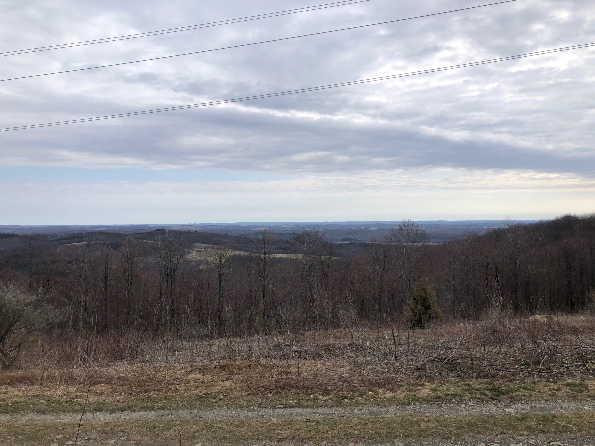
Although the hills in Central New York aren’t that tall, this one sure feels like a mountain. A 180-degree panorama at the summit makes the trail feel like a real mountain hike. Besides the view, a portion of this loop traverses the top of Greek Peak Mountain Resort.
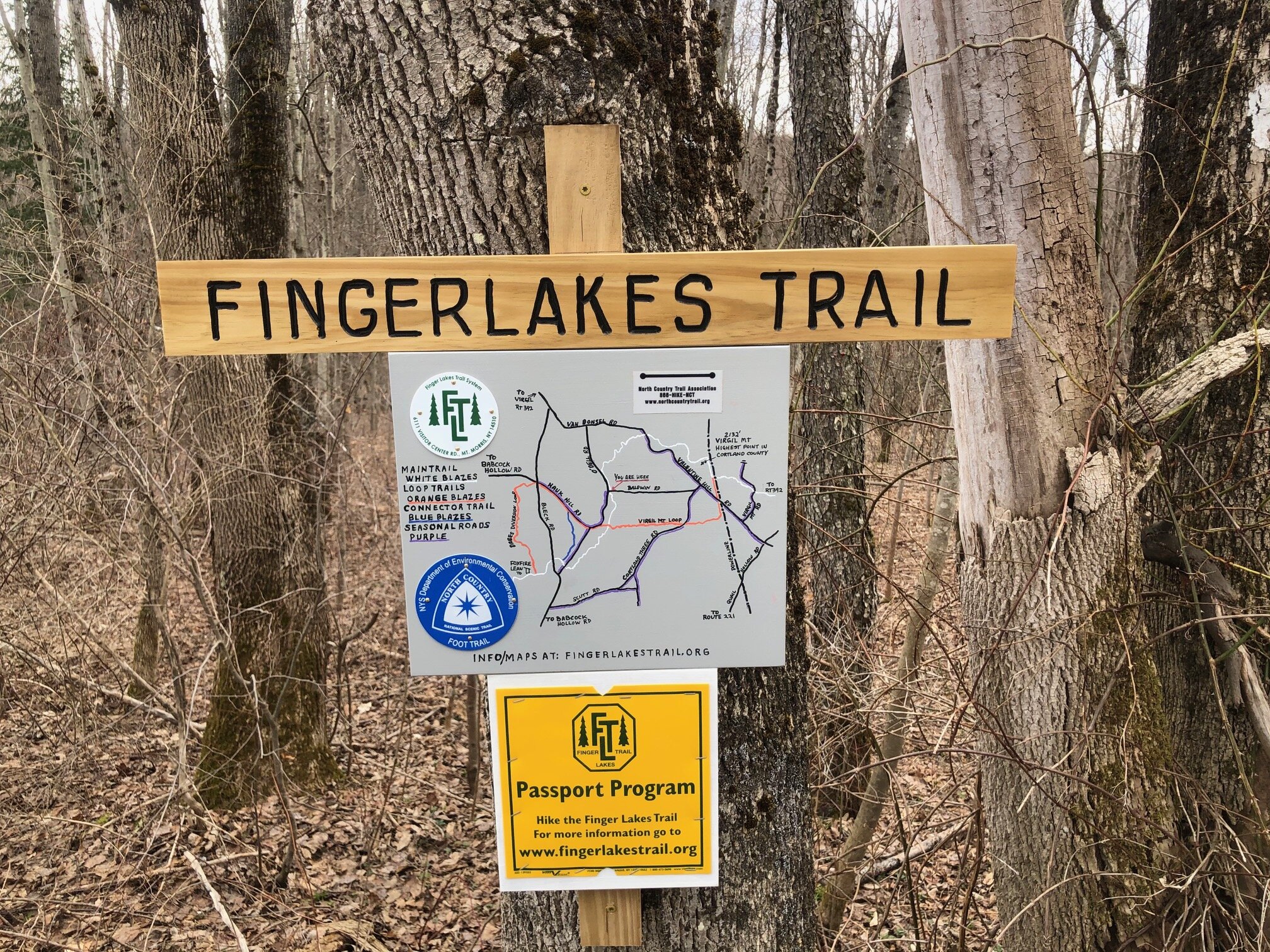
Map of the Virgil Mt. Loop
You can navigate on this route with the downloadable AllTrails map, linked here.
The trailhead for this hike is located at the Finger Lakes Trail parking area at the corner of Odell Road and Baldwin Road. Both are seasonal roads that can be icy in winter. It is marked with a sign showing a basic map of the Virgil Mt. Area loops. The GPS coordinates are 42.48727, -76.1613.
From the trailhead (1710’), follow Odell Road north (uphill). It is marked with white blazes for the Finger Lakes Trail/North Country Trail. The FLT/NCT leaves the road 0.2 miles from the trailhead, heading off to the right. The trail is mostly level here, with a few short ups and downs. Eventually, it descends and crosses a brook before beginning a steep ascent up the backside of Greek Peak. At 1.1 miles, the trail crosses dirt Van Donsel Road. After the road crossing, there is just a bit more climbing before the summit of Greek Peak (2085’). The top of ski lift #2 is located just off the trail.

Despite this being the top of the ski area, it’s not actually the highest point on this loop. Paralleling some ski slopes, the trail descends until the col between Greek Peak and the slightly higher Virgil Mountain. The ascent up Virgil Mountain isn’t as steep as the first climb and there isn’t much elevation to make up from the descent.

The final push up Virgil Mountain
At 2.1 miles, the FLT/NCT reaches the summit of Virgil Mountain, the highest point in Cortland County (2132’). The summit is marked by a sign and survey marker but there isn’t a view from here. However, a short descent on the trail past the true summit will lead to a 180-degree view to the east and north.

From the viewpoint, follow the FLT/NCT to the right, following the access road under the power lines. At 2.4 miles, the main trail veers left away from the power lines while the orange-blazed Virgil Mountain Trail continues under them. Continue straight and follow the orange blazes, which are mostly painted on rocks for now.
The trail continues under the power lines for 0.5 miles before entering the woods on the right. It then climbs to a false summit before merging with a snowmobile trail. Follow the trail downhill, still marked with orange blazes. The orange-blazed trail continues to follow the snowmobile trail, occasionally diverting for a short time. At 4.3 miles, the trail arrives at a four-way intersection with the orange-blazed Dabes Diversion Trail straight ahead and the FLT/NCT (1665’). Turn right onto the FLT/NCT and follow the white blazes. From here, it is 0.5 miles of mostly level walking back to the trailhead. Total distance for this hike: 4.8 miles with 795 feet of elevation gain.