Swedish Loop
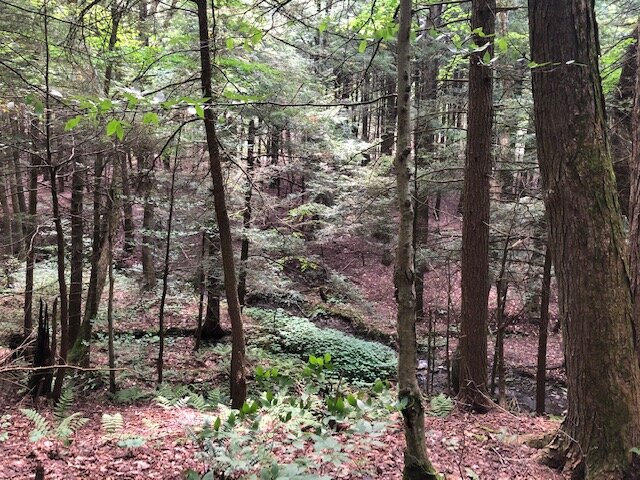
This is another loop that makes use of the vast trail system in Kennedy State Forest. Unlike some of the other loops, such as Virgil Mountain or Dabes Diversion, there aren’t any panoramic views on the Swedish Loop. However, the forest scenery makes up for this, with much of the route being in a beautiful coniferous forest.
Map of the Swedish Loop
You can navigate on this route with the AllTrails map, linked here.
The trailhead for this hike is located at a DEC parking area on County Rd 128A/Daisy Hollow Road, opposite of Carpenter Hill Road. The GPS coordinates are 42.4706, -76.23093. From the trailhead (1525’), follow the white-blazed Finger Lakes Trail/North Country Trail into the woods. You will shortly enter a ravine with Rowland Creek below the trail.

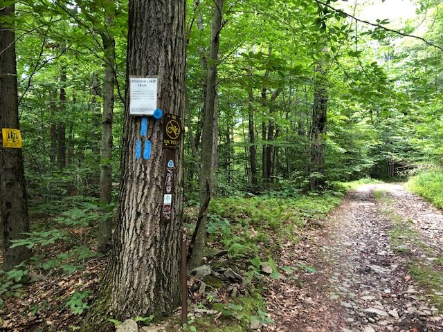
At 0.3 miles, a trail register will be on the left. This next section of trail is gorgeous as it parallels the creek and winds through a forest of hemlocks and other coniferous trees. At 0.9 miles, the trail arrives at a junction with the blue-blazed Swedish Loop Trail. To hike the loop, you may turn left and follow the blue blazes but for these instructions will follow the loop counter-clockwise, continuing straight on the white-blazed FLT/NCT.


From the junction, the FLT descends and crosses Rowland Creek. After the crossing, the Two Creek Campsite will be on the right. The trail now parallels the stream on the opposite side. At 1.1 miles, the yellow-blazed Stockholm Short-Cut Trail enters from the left. This short trail connects with the blue-blazed Swedish Loop Trail and is an option for a shorter hike of less than 3 miles. The FLT starts to ascend gradually and enters a more open forest as higher elevations are reached. At 1.5 miles, the trail crosses dirt Owego Hill Road. There is some room to park on the shoulder here but it’s hard to access the trail from here due to the road’s condition.
After a short ascent past the road, the trail reaches the summit of Owego Hill, which is the high point on this loop (2030’). From here, the trail descends moderately to the junction with the orange-blazed Spanish Loop Trail on the right at 2.0 miles, where there is another trail register. Bear left and continue following the white blazes. Shortly after this junction, there is a short herd-path leading to the old International Mine, which is now just a depression in the land surrounded by some rocks. The path is marked with a cairn.
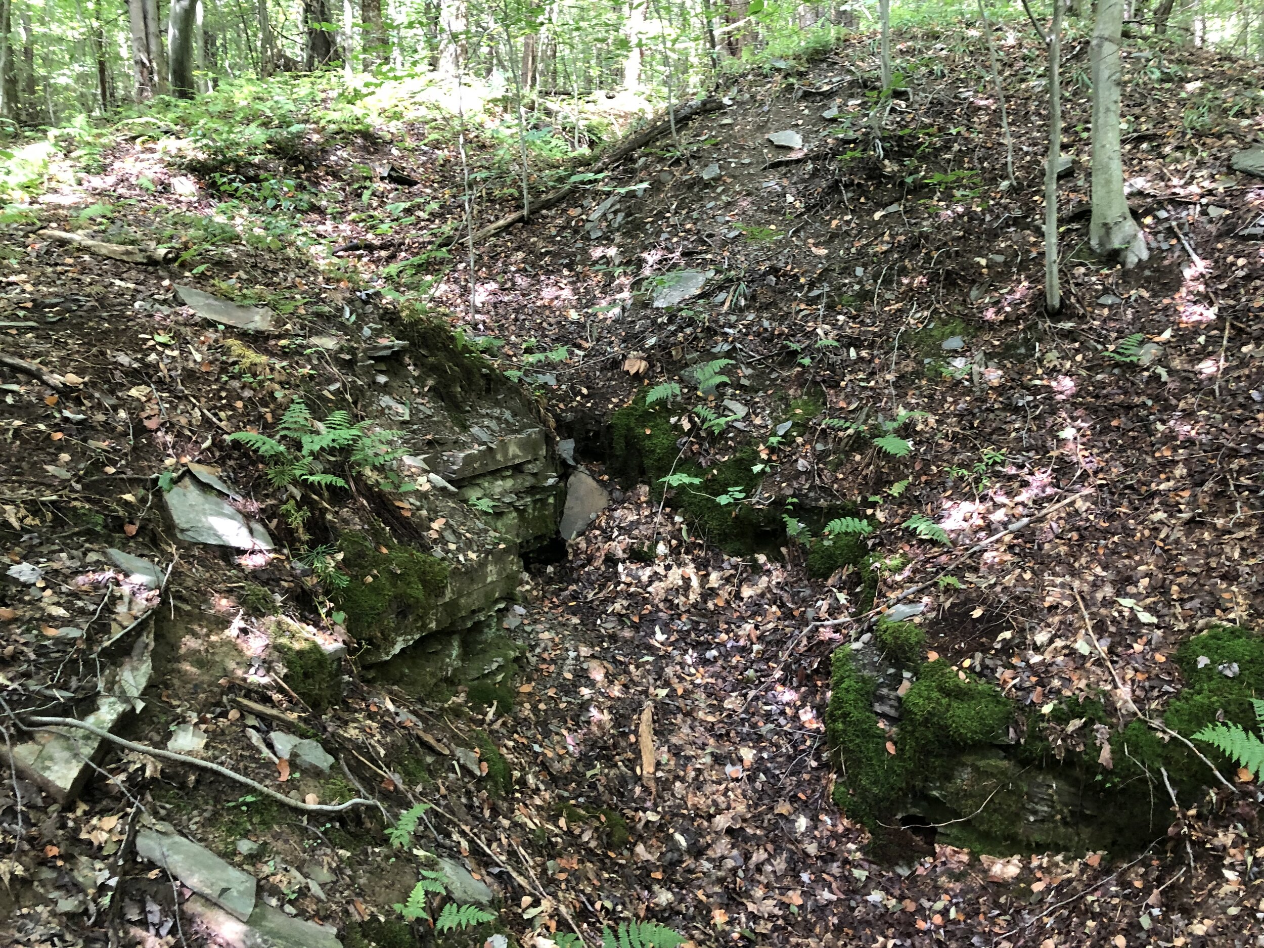
The International Mine
The FLT/NCT continues to descend on easy switchbacks until it reaches dirt Hilsinger Road at 2.7 miles (1775’). This is the eastern terminus of the blue-blazed Swedish Loop Trail. Turn left onto the dirt road. The trail follows the road for 0.5 miles and is still marked with blue blazes.
0.5 miles from the junction, the trail turns left into the forest. It then crosses Owego Hill Road 0.2 miles later. From here, the trail descends, eventually entering that gorgeous coniferous forest from earlier in the loop. At 3.8 miles, the yellow-blazed Stockholm Short-Cut is on the left, which leads back to the main FLT/NCT. Continue straight, following the blue blazes. At 4.0 miles, another yellow-blazed trail called Willa’s Vag enters from the left. “Vag” means “trail” in Swedish and this short trail leads to an overlook of Rowland Creek where there are a few Adirondack chairs stationed.


Continuing on the Swedish Loop Trail, the western terminus at the first junction with the FLT/NCT is reached at 4.2 miles. Turn right and follow the main FLT/NCT 0.9 miles back to the trailhead. Total distance for this hike: 5.1 miles with 660 feet of elevation gain.