Finger Lakes Trail: Texas Hollow and Bog Trail
This section of the Finger Lakes/North Country Trail features a loop around wetlands, a steep climb out of the hollow, and a pond which is great for birding. This hike, especially the part near the bog, has a very isolated and remote character. It’s easy to forget this is just a few miles from a state highway and the rest of civilization.
Map of the FLT/NCT in Texas Hollow with the Bog Loop Trail
You can navigate on this route using the downloadable AllTrails map.
The trailhead for this hike is located at the FLT shoulder parking on Texas Hollow Road, about one mile off NYS Route 79. The GPS coordinates are 42.41538, -76.79438.

FLT access point on Texas Hollow Rd
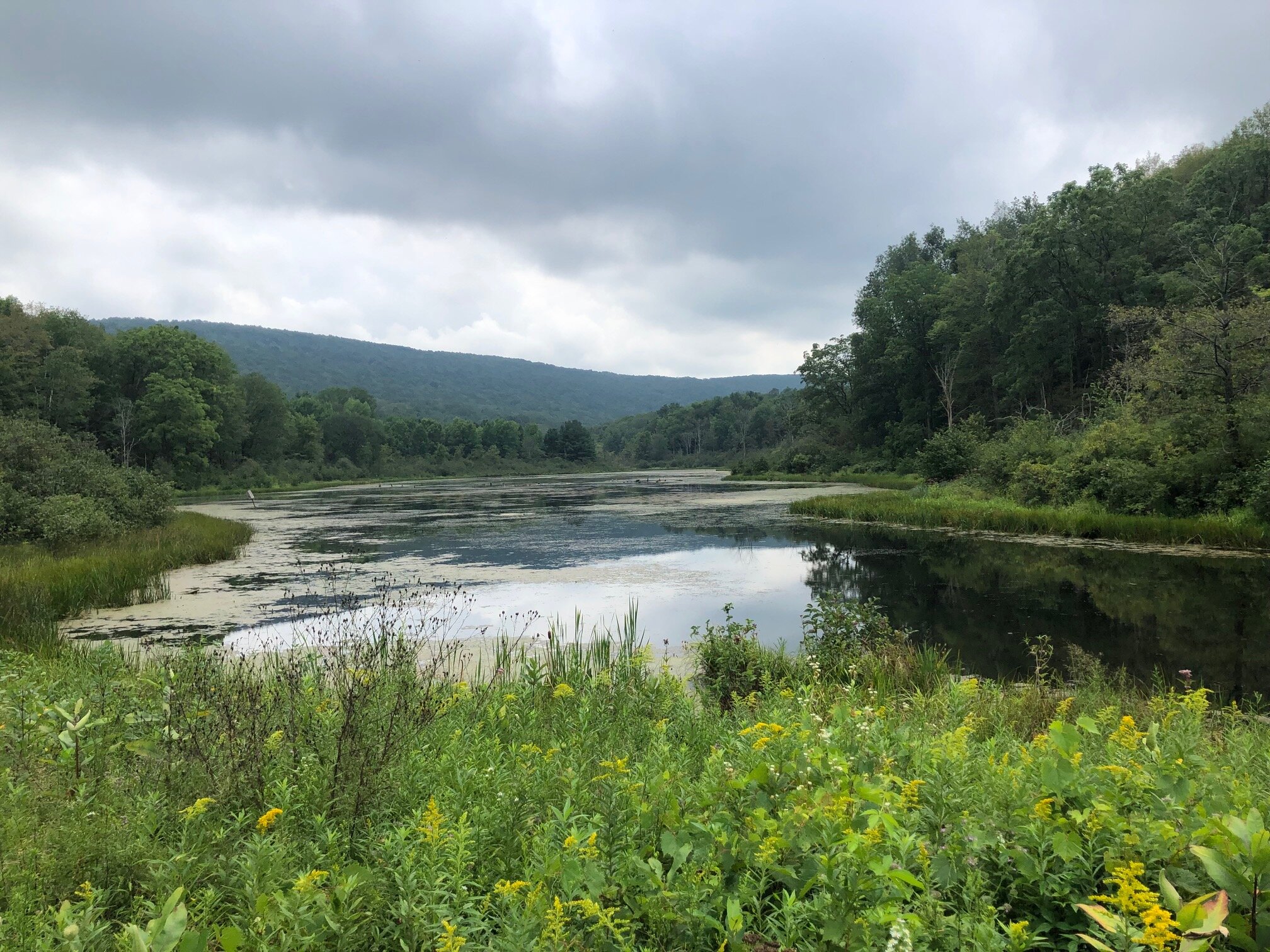
From the trailhead (1245’), follow the white-blazed Finger Lakes/North Country Trail off the east side of the road (heading downhill). The trail is mostly level from here, heading parallel to the road. At 0.3 miles, the trail joins an access road to the Texas Hollow Pond. Turn left here and follow the trail through a clearing right next to the pond.

View of Texas Hollow next to the pond
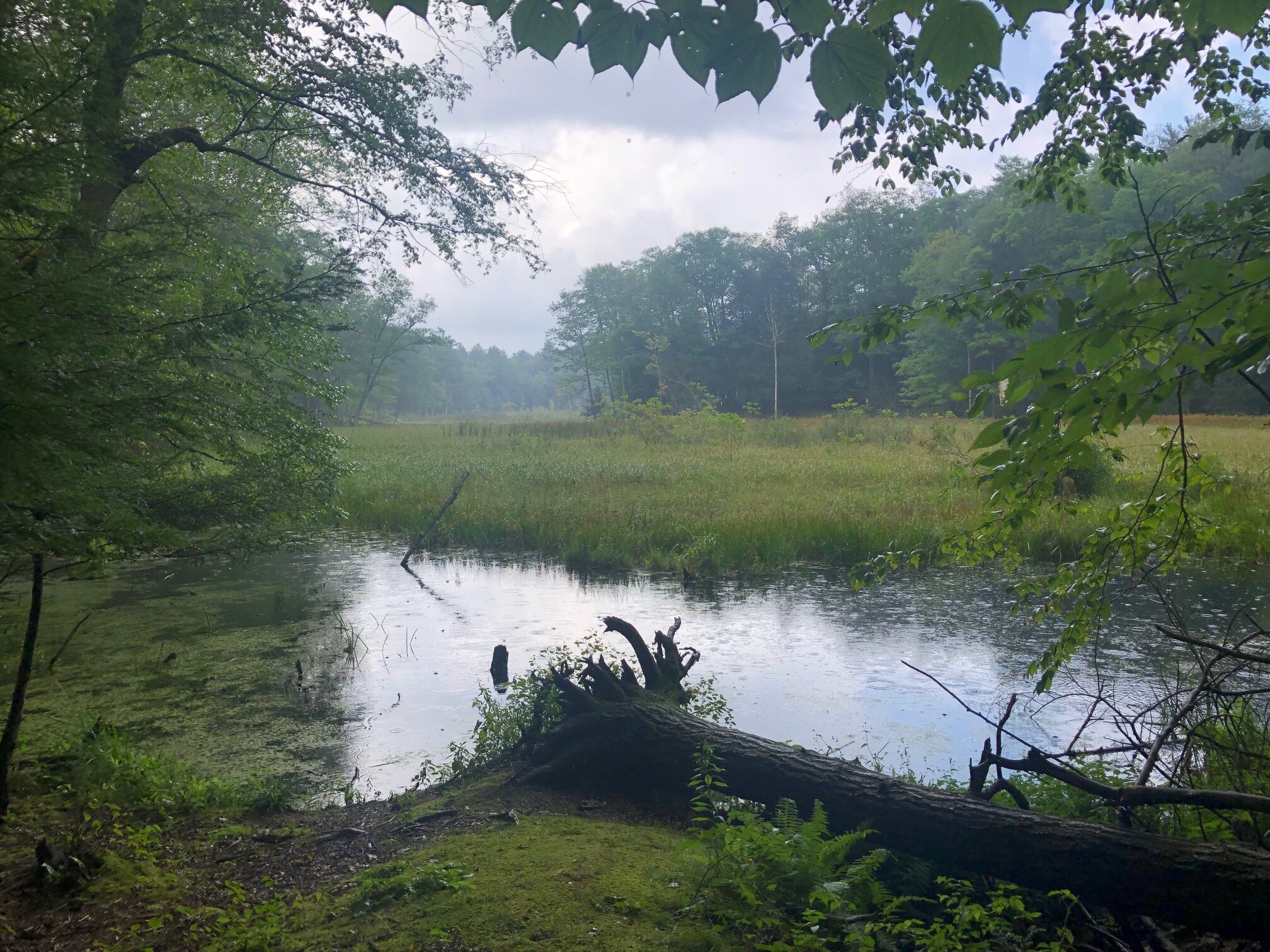
Just after passing through the clearing, the FLT/NCT reaches a junction with the blue-blazed Bog Loop Trail. This short trail loops around some nice wetlands, with the route being just 0.4 miles longer than bypassing via the main trail (the 5-mile distance includes the Bog Loop in the outbound direction). Turn left here and follow the blue blazes.
Even though this trail travels next to the wetlands, it never actually goes through them and is in good condition. Shortly after the junction, the first view of the bog is on the right where there is a nice spot to take a break. After paralleling the bog for a bit, the trail starts to loop around to the other side, winding through a hemlock forest. There aren’t as many views on the other side of the bog, but there is a nice one just before the blue-blazed trail meets the FLT/NCT again, at 1.1 miles from the trailhead.
At the eastern terminus of the Bog Loop (1195’), turn left and follow the white-blazed FLT/NCT once again. The trail crosses a muddy area on puncheons before paralleling the pond from before again, this time in a mixed forest of hemlocks and hardwoods. After running near the pond for a bit, the trail begins a gradual ascent away from the water. The ascent steepens at 1.8 miles, as the trail approaches the steep slope on the east side of Texas Hollow. From here, the ascent is mostly consistent with a few steep sections mixed in. The gradient lessens at 2.1 miles and the trail follows the slope’s ridge from here on.

One of the steep climbs out of Texas Hollow
At 2.7 miles, the FLT/NCT reaches a road crossing at Newtown Road (1790’), which is the turnaround point for this hike. Retrace your steps back down the hill until the junction with the blue-blazed Bog Loop. This time, continue straight on the main FLT/NCT instead of taking the Bog Loop, unless you want to extend the route by 0.4 miles.

Newtown Road crossing
The FLT/NCT reaches the western junction of the Bog Loop 0.3 miles from the eastern junction. From here, follow the FLT/NCT through the clearing next to the pond and back into the woods, reaching Texas Hollow Road in 0.4 miles. Total distance for this hike: 5.0 miles with 860 feet of elevation gain.