Jones Hill
A steep climb to this hang glider jump-off rewards offers a magnificent view of Labrador Hollow and valleys to the west. Certainly one of the best views on the Finger Lakes Trail System, this short hike is well worth the effort.
Map of the Jones Hill out-and-back
You can navigate on this route using the downloadable AllTrails map.
The trailhead for this hike is located at the Tinker Falls Parking Area on NYS Route 91, between Truxton and Apulia. The GPS coordinates are 42.78012, -76.03592. The parking lot may look full, but most of the traffic should head on the easy trail to Tinker Falls.
From the trailhead (1250’), locate the trail entrances on the opposite side of the road. There are two trails that start from here. One leads right 0.2 miles to Tinker Falls while the trail on the left leads to the Onondaga Trail and Jones Hill (the sign says “scenic overlook”). Turn left here and climb a short set of wooden steps.

Shortly after this first junction, you will arrive at another four-way intersection with the orange-blazed Skyline Trail. The Skyline Trail continues straight and on the left, while the trail on the right connects to the Tinker Falls Trail. Continue straight here and follow the orange blazes up an old woods road.
This next section is probably the steepest section of the entire route. Since the climbing is on a woods road, it’s not technical but definitely is a calf-burner. At 0.25 miles, the trail leaves the road on the right. Continue following the orange blazes. After a short, level walk, the orange-blazed trail arrives at a T-intersection with the blue-blazed Onondaga Trail/North Country Trail (1520’). Turn left here and follow the blue blazes uphill.
The trail continues uphill but isn’t as steep as before. In some places, switchbacks help to ease the grade. At 0.6 miles from the trailhead, the trail merges with the access road once again. Turn right and follow the road uphill, still marked with blue blazes.

Onondaga Trail/NCT on the climb up Jones Hill
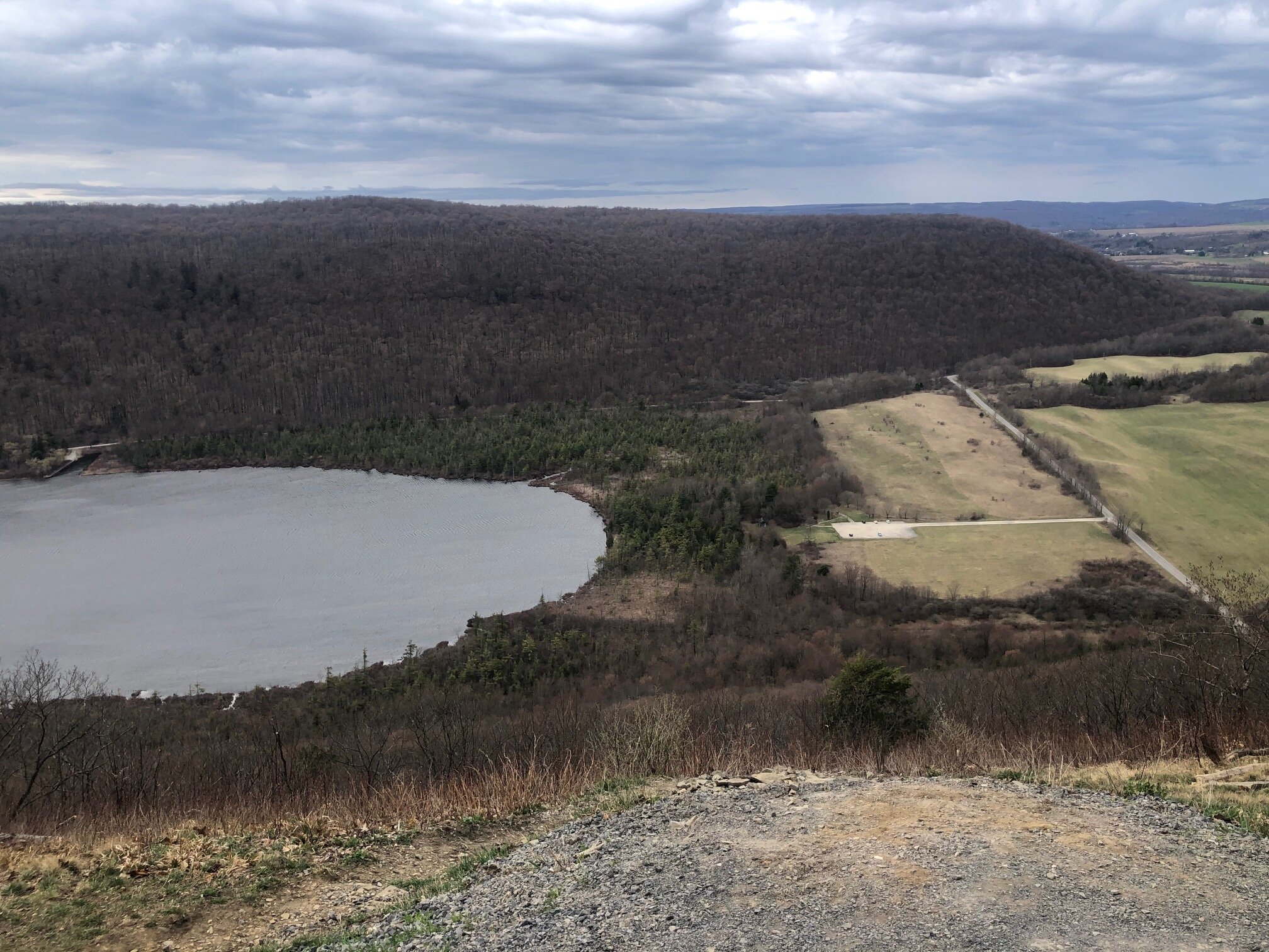
This part of the access road is easy climbing and some views can be seen through the trees. At 1.0 miles, the Onondaga Trail leaves the road to the left, following the edge of the steep hill. It then continues for 0.2 miles until the summit of Jones Hill (1930’). From here, there are expansive views down into Labrador Hollow and the surrounding hills to the west.


After enjoying the view, retrace your steps back to the trailhead on Route 91. Alternatively, you could continue on the Onondaga Trail to Spruce Pond, which is the starting point for both the Fellows Hill Loop and Shackham Pond hikes. Spruce Pond is 1.3 miles from here on less difficult terrain. Total distance for this hike: 2.4 miles with 635 feet of elevation gain.