Potomac Ponds & Hector Backbone Loop
The Finger Lakes National Forest is unique, to say the least. On this loop, trail users will encounter a number of small ponds, a swamp, group campgrounds, fields, and even cows. These are technically two separate loops but it’s recommended that they be combined into one hike for the best experience. This hike is almost all flat as well, so the miles will go by faster than most other hikes in the region.
You can navigate on this route with the downloadable AllTrails map.
The trailhead for this hike is located at the Blueberry Patch parking area on Picnic Area Road, which is also the parking area for the Burnt Hill Loop. The GPS coordinates are 42.48423, -76.79606.
From the trailhead (1800’), locate the orange-blazed Interloken Trail across the road. Follow this level trail north. In 0.2 miles, the Potomac Trail enters on the right. Turn right and follow this trail. The Potomac Trail heads slightly downhill, winding its way through a mixed forest until it crosses Potomac Road at 0.7 miles from the trailhead. Continue straight, picking up the trail across the road.
The trail ascends slightly before emerging into an access road at 1.1 miles. Turn right and follow the road, which leads to the Potomac Group Campground. Just before the road enters a clearing, the Potomac Trail resumes on the left. When turning onto this trail, there will be a fork with the trail to Potomac Ponds on the left and another loop trail on the right. For this route, take the left side of the fork.
The trail passes by a few campsites on the left before passing two ponds on the left side of the trail at 1.3 miles.

After passing these ponds, the trail crosses Potomac Road again at 1.7 miles. After this crossing, it passes more campsites on both sides of the trail before arriving at a junction with the Interloken Trail at 1.9 miles. Turn right and follow the orange blazes.
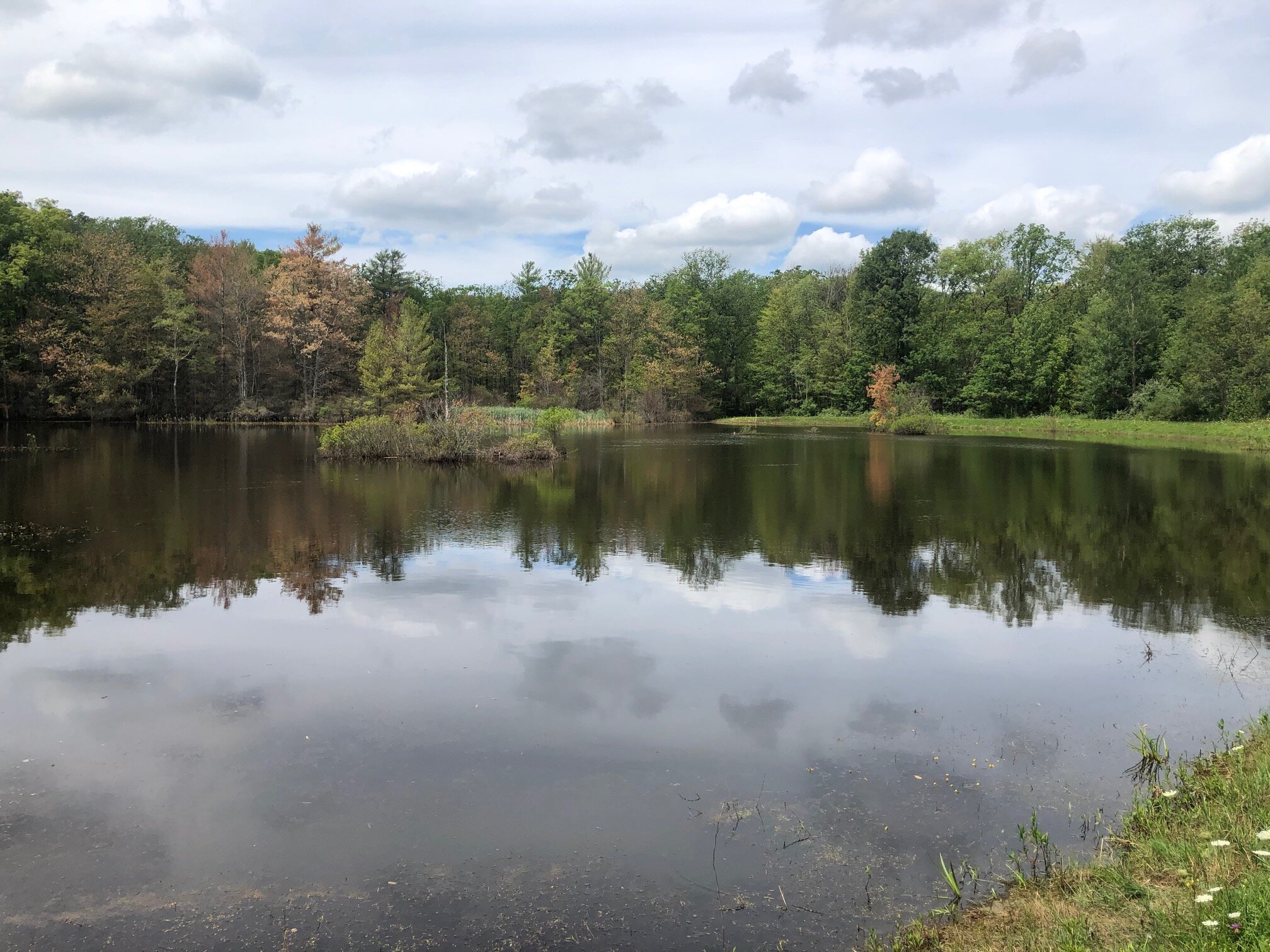
Immediately after this junction, the Interloken Trail passes Foster Pond on the right, which is larger than the previous two ponds. After the pond, the Backbone Trail comes in from the left. This trail will be used to complete the loop. For now, follow the Interloken Trail to the right which coincides with the Backbone Trail for a few hundred feet. The Backbone Trail then turns right and the Interloken Trail continues straight. Follow the Interloken Trail.

Foster Pond

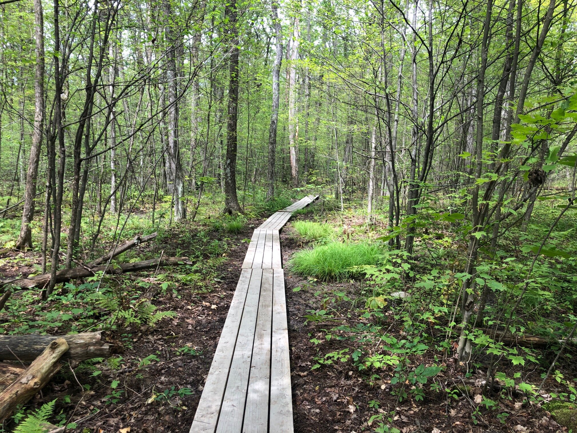
The Interloken Trail now has a long stretch without any junctions. During this section, the trail crosses over boardwalks and travels through a variety of forests. At 3.2 miles, the trail comes to another intersection with the Backbone Trail. This time, turn left and follow the wide trail.
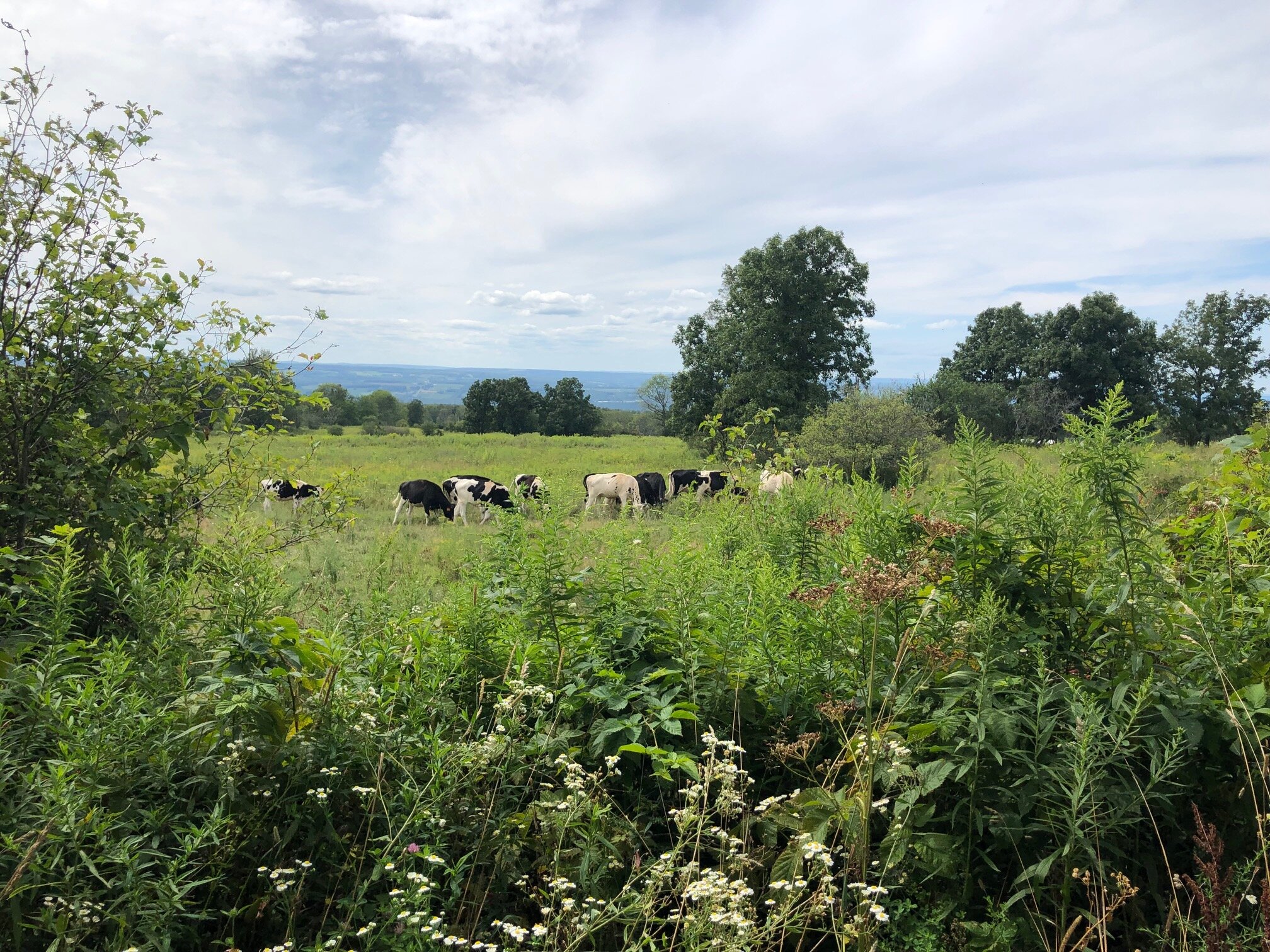
The Backbone Trail is a horse trail, so it is almost always wide and flat. This section of the hike is still interesting, however. About 0.3 miles from the intersection, the trail enters a cow pasture through a gate (please close the gate behind you as to not let the cows out!). From here, there are great views down to Seneca Lake and the surrounding hills. After crossing through the field, the trail exits the pasture through another gate and comes to a junction with the No-Tan-Takto Trail on the right. Turn left to continue following the Backbone Trail, following signs for the Backbone Horse Camp.

The Backbone Trail passing through the pasture

This section of the Backbone Trail parallels two pastures, and cows can often be spotted from here. After a long walk next to the pastures, the trail crosses a large wooden bridge and arrives at an intersection at 4.8 miles. Both directions are designated as Backbone Trail. Turn left and follow the trail as it heads slightly uphill.

0.75 miles from this junction, the Backbone Trail loops back to the Interloken Trail. Turn right and follow the orange blazes past Foster Pond and to the junction with the Potomac Trail. Turn right and continue to follow the Interloken Trail. The trail’s terrain is mostly consistent with the terrain north of Foster Pond, with a few small ups and downs. The Blueberry Patch parking area is 1.25 miles from Foster Pond. Total distance for this hike: 6.8 miles with 510 feet of elevation gain.