Burnt Hill Loop
This hike loops around the flat top of Burnt Hill and features a nice combination of fields and forest. The fields offer great views of Seneca Lake and during the warmer months, you’ll likely share the fields with cows! Like most other trails in the Finger Lakes National Forest, there is little elevation change on this hike, making it great for beginners.
Map of the Burnt Hill Loop
You can navigate on this route with the downloadable AllTrails map.
The trailhead for this hike is located at the Blueberry Patch Parking Area, on Picnic Area Road. This is also the trailhead for the Potomac Ponds-Backbone Loop. The GPS coordinates are 42.48452, -76.79643.
From the trailhead (1800’), follow the sign at the edge of the parking lot for the Burnt Hill Trail. The trail first passes through the woods, but then parallels a field. The terrain here is easy, with the trail being both wide and flat. Horses are allowed on this trail as well, so use caution. The trail passes through a mixture of fields and woods for the first 0.7 miles. Eventually, it arrives at a cow pasture, which is accessible by a gate. Be sure to close the gate behind you as there are cows during the warmer months in these pastures! The trail heads in a straight direction through the field, passing the Burnt Hill Radio Tower on the right. It then leaves the field, passing through a small section of forest. At 1.1 miles, the trail crosses Mathews Road, where there is a small parking area.

From here, cross the road and continue following the Burnt Hill Trail, which heads mostly south with a few turns west. At 1.9 miles, the trail comes to a four-way intersection with the orange-blazed Interloken Trail (1790’). The Burnt Hill Trail continues 0.25 miles to Burnt Hill Road while the Interloken Trail is to the left and right. Turn right here and follow the orange blazes.

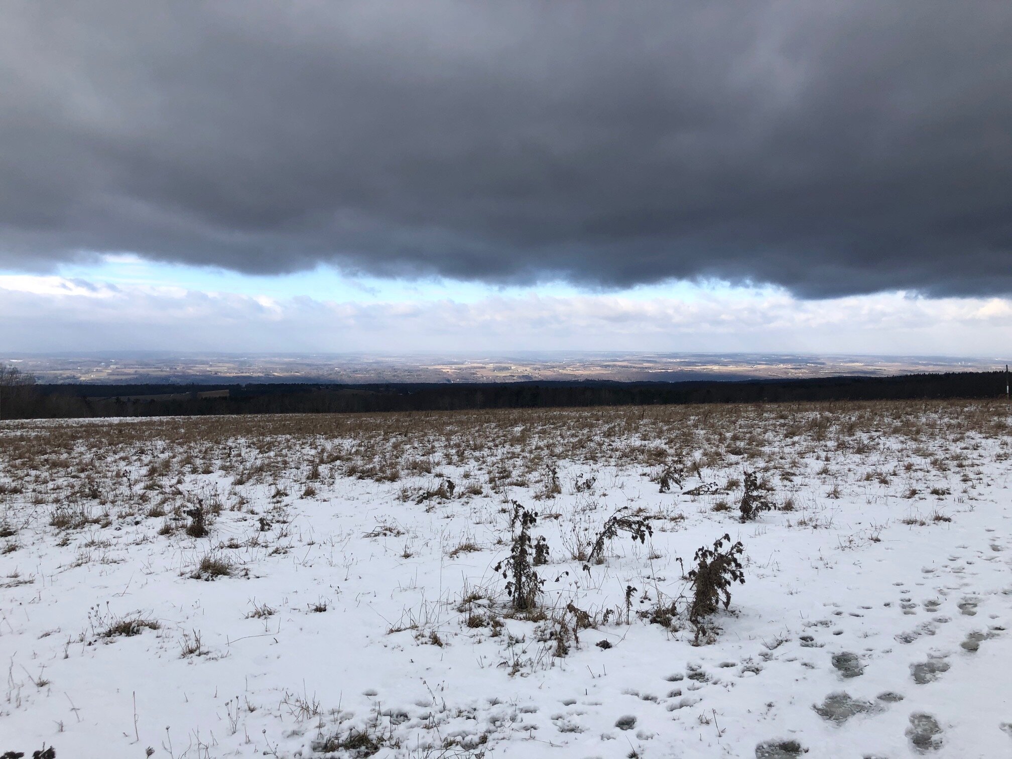
The Interloken Trail is a bit skinnier than the Burnt Hill Trail, but it is still easy terrain. In a few places, boardwalks assist trail users in navigating muddy spots. At 2.5 miles, the trail crosses Mathews Road again, entering a cow pasture through a gate. As the trail crosses this pasture, there are wonderful views to the west.

After the pasture, the trail continues its way through the forest, crossing a few small streams with more boardwalk sections. At 3.3 miles, the trail comes to an intersection with the Ravine Trail. This trail descends into a small ravine and eventually ends at Picnic Area Road, so this is a nice extension to the Burnt Hill Loop. Continue straight on the Interloken Trail.
In 0.3 miles from the Ravine Trail junction, the Interloken Trail arrives at Picnic Area Road. Turn right and follow the road 0.2 miles back to the parking area. Total distance for this hike: 3.8 miles with 255 feet of elevation gain.
